Actionable Insights from Imagery, 3D Point Clouds & Document Intelligence

At Tiecken Solutions, we leverage advanced Computer Vision, 3D LiDAR analysis, and Document Intelligence to turn complex visual data, point clouds, and engineering documents into actionable intelligence.

3D Point Clouds
LiDAR, Gauge Clearance & Scan-to-BIM
Computer Vision
Rail & Infrastructure Inspections
Agentic AI
Autonomous Workflows & Data Pipelines
3D Point Cloud Asset Detection Showcase
3D LiDAR & AI Analytics
Point Cloud & Multi-sensor Fusion
AI Solutions

Insights Through Tailored & Pragmatic AI

No two infrastructure organizations, inspection workflows, or data pipelines are identical. At Tiecken Solutions, we avoid generic off-the-shelf software and focus on dedicated, client-specific solutions.

We thoroughly analyze your operational challenges, existing software architecture, and data formats upfront. Whether dealing with rail track visual inspections, 3D LiDAR datasets, or technical documentation, we engineer and deploy AI models tailored specifically to your needs.

Our Mission

At Tiecken Solutions, we transform complex visual datasets, 3D point clouds, and documentation into automated, actionable insights. We empower organizations to perform asset inspections, safety audits, and maintenance planning faster, safer, and with higher precision using Computer Vision and AI.

Computer Vision

High-speed 2D image recognition & asset inspection

3D LiDAR & Point Clouds

3D point clouds, clearance profiling & Scan-to-BIM

Agentic AI Workflows

Autonomous AI agents & automated data pipelines

Document Intelligence

Document AI & technical specification analysis

Our Solutions in Practice

Proven AI applications and real-world projects covering image recognition, 3D point cloud analysis, and GIS localization. Click any visual to enlarge.

Catenary object detection 2 Images
Computer Vision & 2D

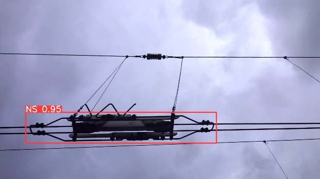
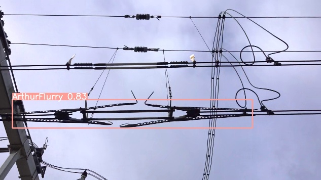
Catenary Object Detection

Development of a Computer Vision model that automatically detects overhead line (catenary) components from high-speed imagery. Significantly accelerates inspection routines and ensures consistent object classification.
Catenary detection 1
Catenary detection 2
Insulated Rail Joint GeoTIFF Mapping 4 Images
Computer Vision & Geolocalization

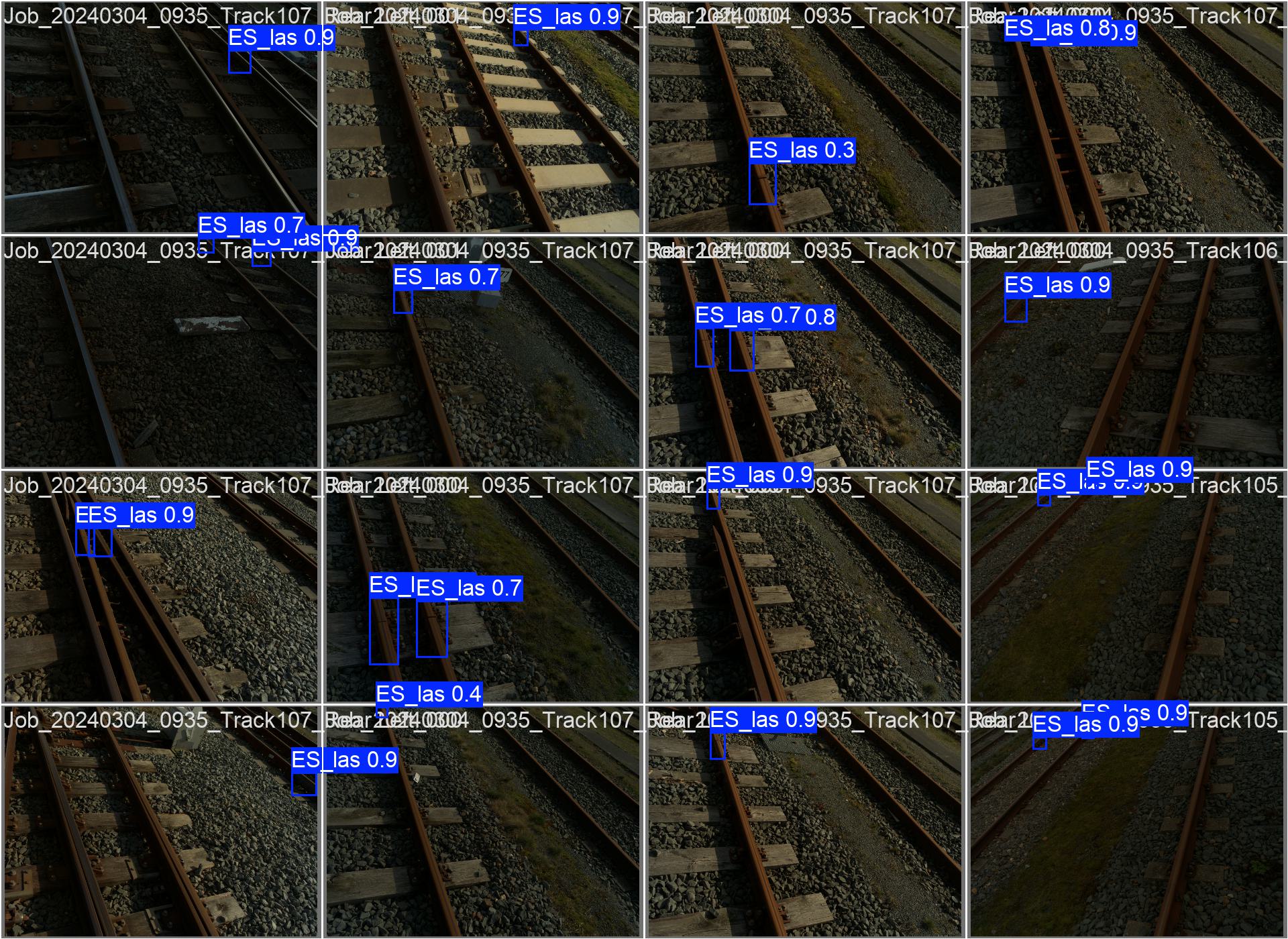
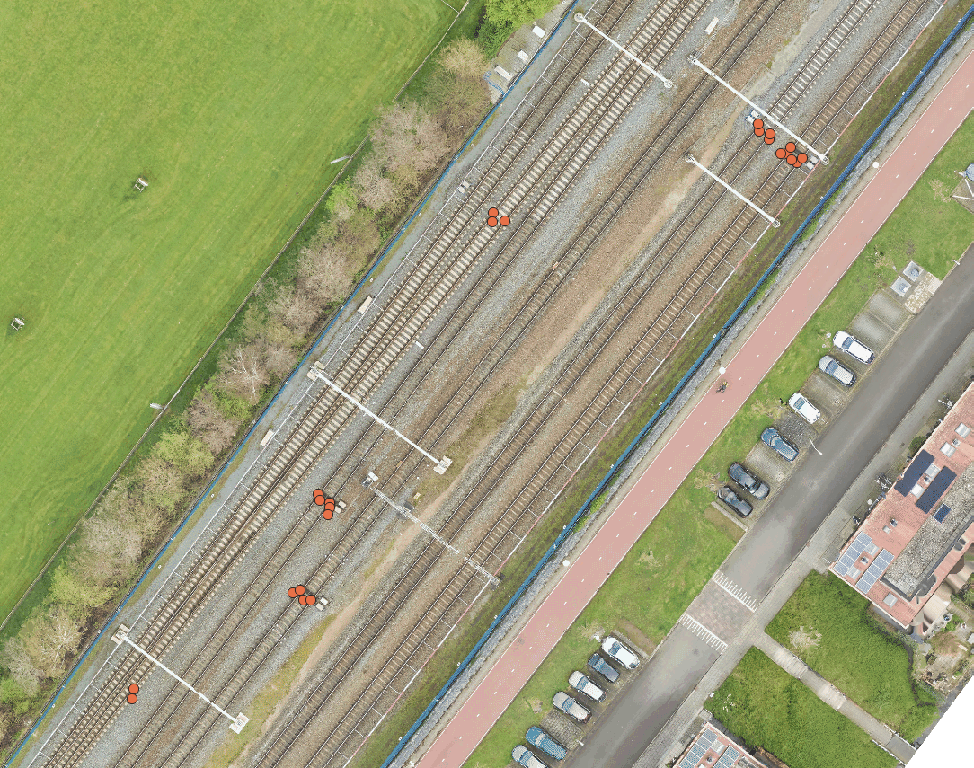
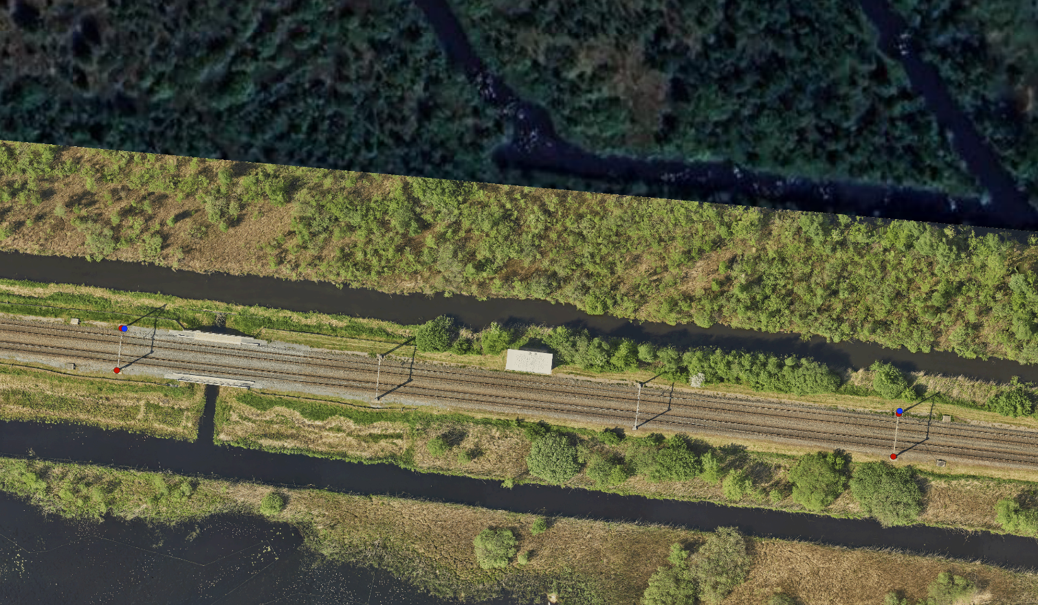
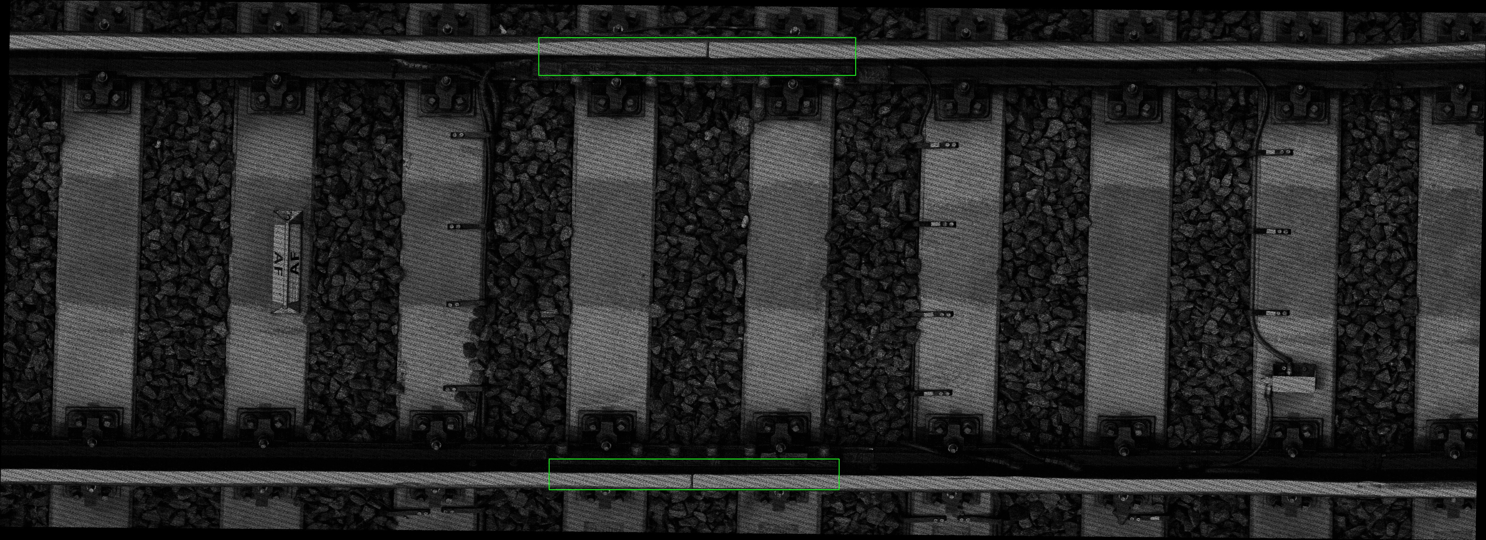
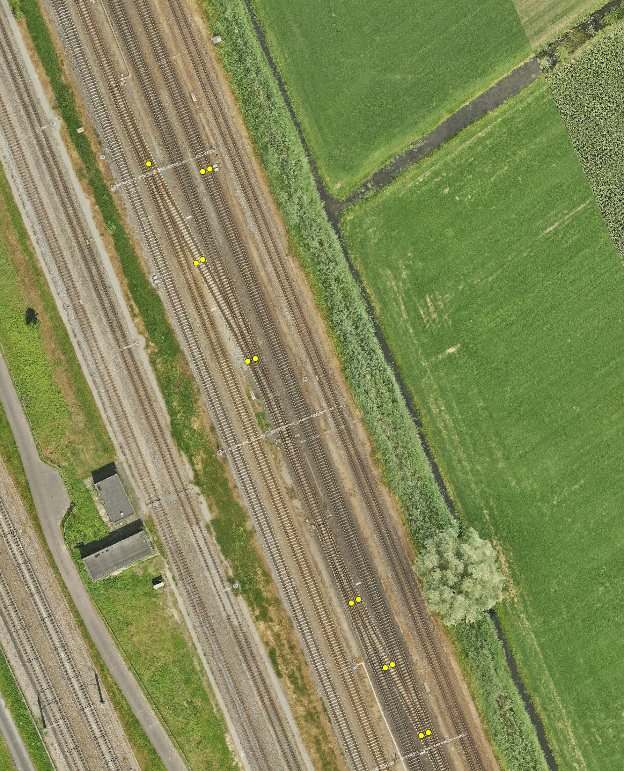
Insulated Rail Joint Detection & Localization

Automated detection and high-precision positioning of insulated rail joints (IRJs) using two complementary localization methods: GeoTIFF mapping with top-down linescan cameras and triangulation across forward-facing camera feeds.

GeoTIFF Linescan 1
GeoTIFF Linescan 2
Camera Triangulation 1
Camera Triangulation 2
Counterweight Measurement Point Detection 2 Images
Computer Vision & Measurements

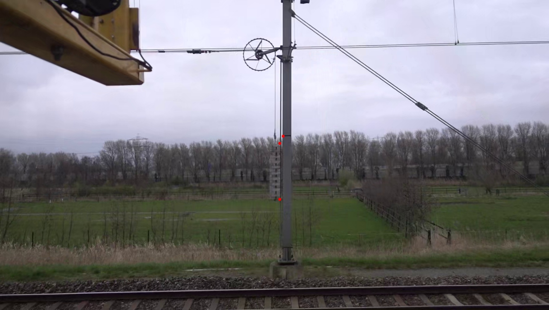
Catenary Counterweight Measurement

Automated vision-based system to verify the position of catenary tension counterweights safely from a distance, removing the need for inspectors to enter active track areas.

Measurement Point 1
Measurement Point 2
Insulation Gap Segmentation
Computer Vision & Segmentation

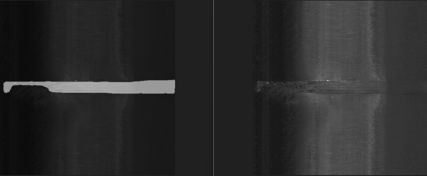
Rail Joint Insulation Analysis

Image segmentation application that detects insulation layers within rail joints. Using calibrated pixel scaling, the system calculates the exact minimum thickness and identifies structural wear.

3D Vegetation Segmentation 2 Images
Point Clouds & LiDAR

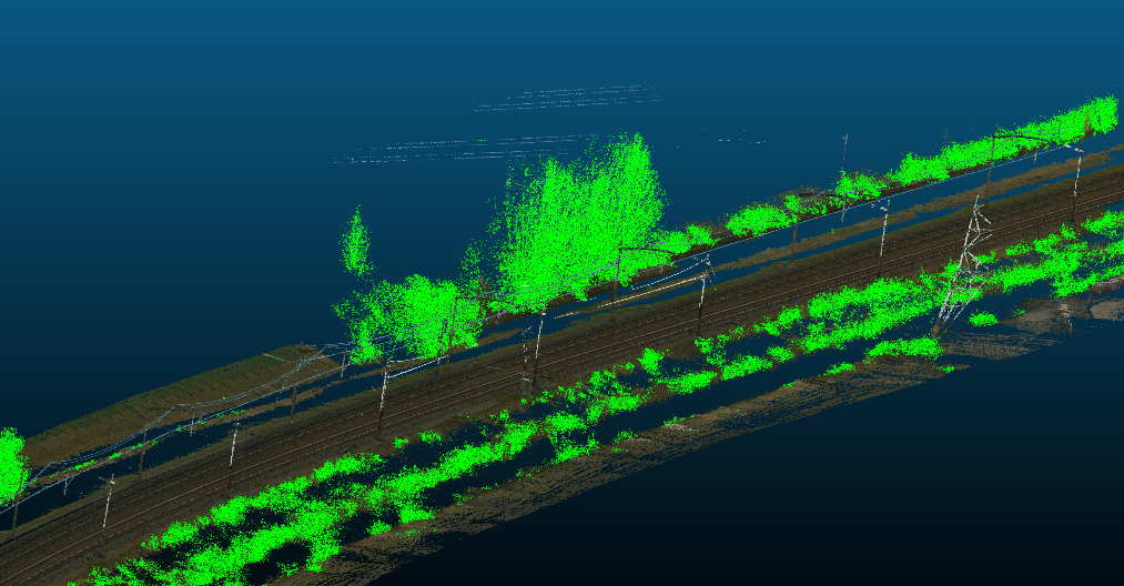
3D Railway Vegetation Control

3D point cloud segmentation model that classifies rails, overhead lines, and vegetation. Calculates millimeter-precise clearances between vegetation and critical rail assets to optimize trimming schedules.

3D Vegetation 1
3D Vegetation 2
Asset Detection in BEV and 3D 2 Images
Point Clouds & LiDAR

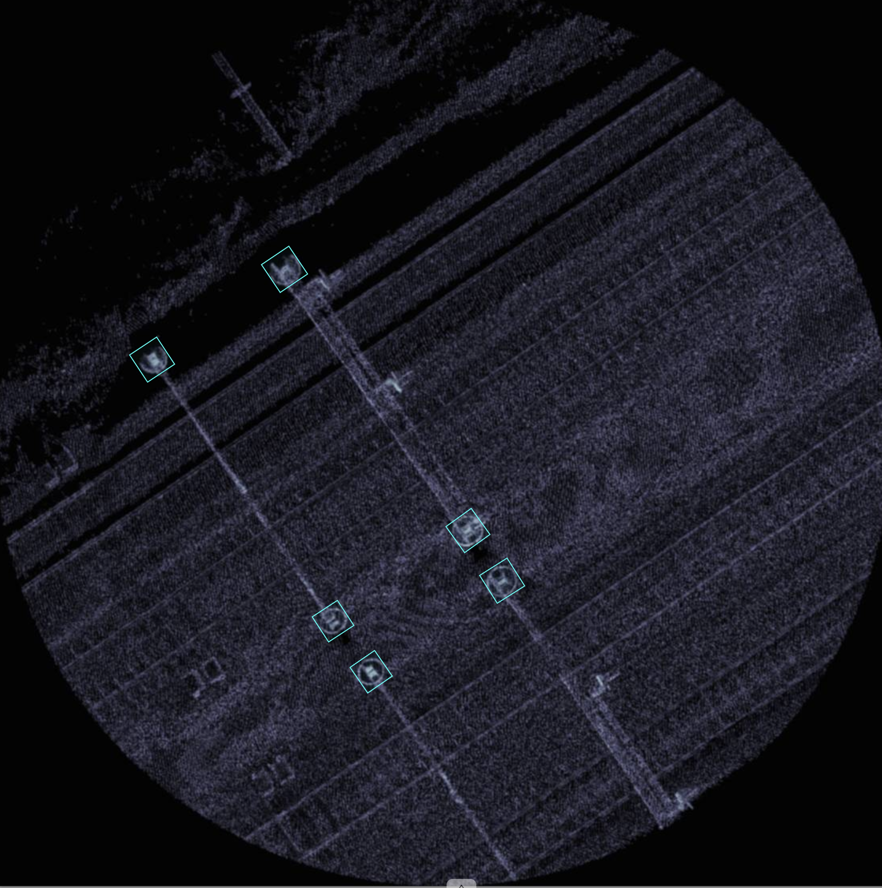
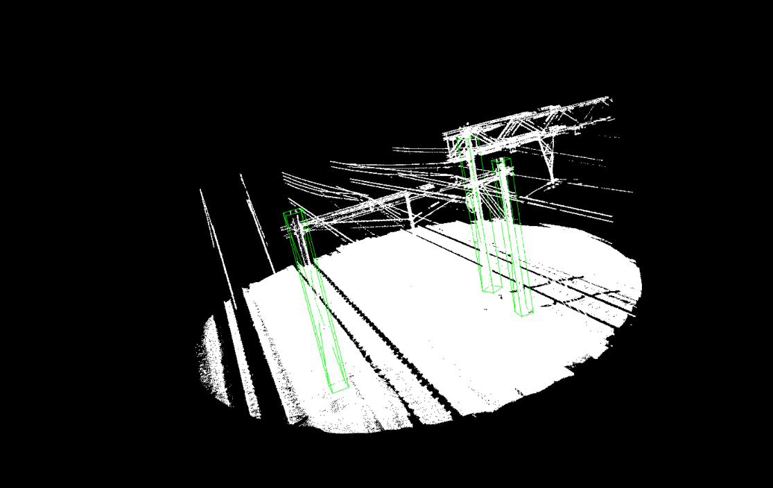
3D Point Cloud Asset Detection

Infrastructure asset identification using both Bird's-Eye-View (BEV) projections and direct 3D spatial object recognition—ideal when 2D camera footage is occluded or height metadata is essential.

Point Cloud BEV
3D Direct Detection
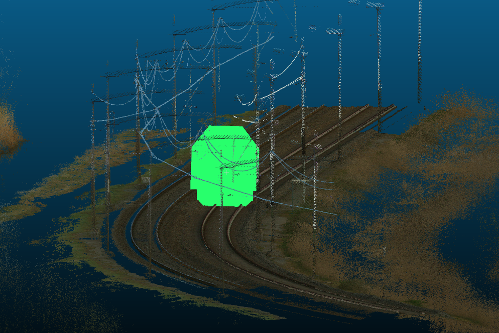
Collision Detection Envelope Simulation
3D Point Clouds & Safety

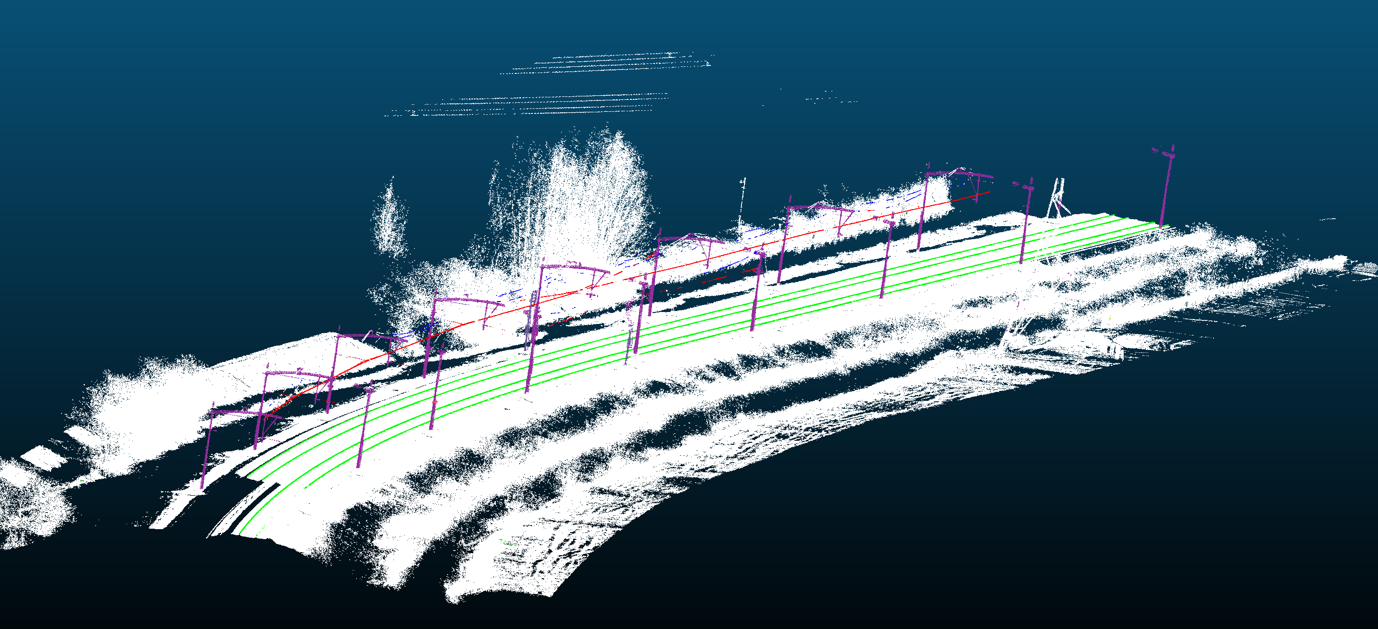
3D Clearance & Collision Detection

Combining 3D point clouds with high-precision GPS and IMU data (pitch, yaw, and roll). A virtual vehicle gauge clearance model traverses the point cloud to identify potential infrastructure collisions.

3D LiDAR Point Clouds & Scan-to-BIM

Large-scale 3D point clouds hold valuable insights for rail network operators, engineering consultancies, and contractors. Our AI algorithms automatically process millions of LiDAR points into classified spatial objects and clearance analytics.

Furthermore, we continually invest in R&D for automated Scan-to-BIM workflows, enabling faster conversion of raw 3D point cloud data into structured CAD and BIM models.

3D Segmentation & Clearance

Automated detection of rails, vegetation, signal posts, masts, and overhead wires in LiDAR point clouds with millimeter-grade clearance measurements.

Scan-to-BIM Workflows

Our innovation roadmap focuses on converting 3D LiDAR point cloud datasets into structured, open-standard 3D BIM models (IFC) for civil infrastructure.

Agentic AI & Document Intelligence

Autonomous AI agents and RAG pipelines designed to search, analyze, and integrate complex technical specifications, standards, and engineering reports into your workflows (including local / on-premise deployment).

Featured Projects & Collaborations

Pragmatic AI, Computer Vision, and inspection software developed for and in partnership with leading infrastructure and rail operators.

Client Quote

System Integration & Data Pipeline for Leonardo Inspection Train

"Tiecken Solutions is the partner with which Strukton Rail develops and implements groundbreaking, railway-related innovations in a pragmatic way. Innovations that are conceived and rolled out together with our operations."

Project

Detection & Localization of Insulated Rail Joints

In collaboration with IGL (Masters in Measurement), we developed advanced Computer Vision algorithms for automated detection and high-accuracy geographic positioning of insulated rail joints (IRJs) across railway networks.

The Team Behind Tiecken Solutions

Personal commitment, deep AI expertise, and extensive domain experience in rail engineering and civil infrastructure.

Sjoerd Tiecken

Sjoerd Tiecken

Co-Founder / Principal AI Engineer

Specialized in Computer Vision, Deep Learning, 3D LiDAR processing, and building custom AI software for railway inspections and smart asset management.

Connect with Sjoerd on LinkedIn
Jacques Tiecken

Jacques Tiecken

Co-Founder / Senior Advisor & Infra Specialist

Extensive experience in rail engineering, measurement technology, innovation, and process integration in complex infrastructure projects.

Connect with Jacques on LinkedIn