Actionable Insights from Imagery, 3D Point Clouds & Document Intelligence

At Tiecken Solutions, we leverage advanced Computer Vision, 3D LiDAR analysis, and Document Intelligence to turn complex visual data, point clouds, and engineering documents into actionable intelligence.

3D Point Clouds
LiDAR, Gauge Clearance & Scan-to-BIM
Computer Vision
Rail & Infrastructure Inspections
Agentic AI
Autonomous Workflows & Data Pipelines
3D Point Cloud Asset Detection Showcase
3D LiDAR & AI Analytics
Point Cloud & Multi-sensor Fusion
AI Solutions

More answers from the survey data you already hold

Many asset owners hold surveys, inspection imagery and engineering documentation that were used once and then archived. That data typically holds far more information than it was captured for.

We analyse point clouds, imagery and documents automatically and deliver asset data you can act on: a position, a measured value and the source image for every object. Our methods were developed on rail projects and apply to other linear infrastructure and industrial sites.

Our Mission

We build software that turns inspection imagery, 3D point clouds and engineering documentation into asset data automatically. Asset owners and engineering firms use it to carry out inspections, asset registration and safety checks faster, with less work in the field.

Computer Vision

High-speed 2D image recognition & asset inspection

3D LiDAR & Point Clouds

3D point clouds, clearance profiling & Scan-to-BIM

Agentic AI Workflows

Autonomous AI agents & automated data pipelines

Document Intelligence

Document AI & technical specification analysis

Asset data from existing scans and imagery

Tensioners and droppers measured automatically from mobile laser scanning data; insulated rail joints detected and located on inspection imagery. No possessions and no site visits. Click any visual to enlarge.

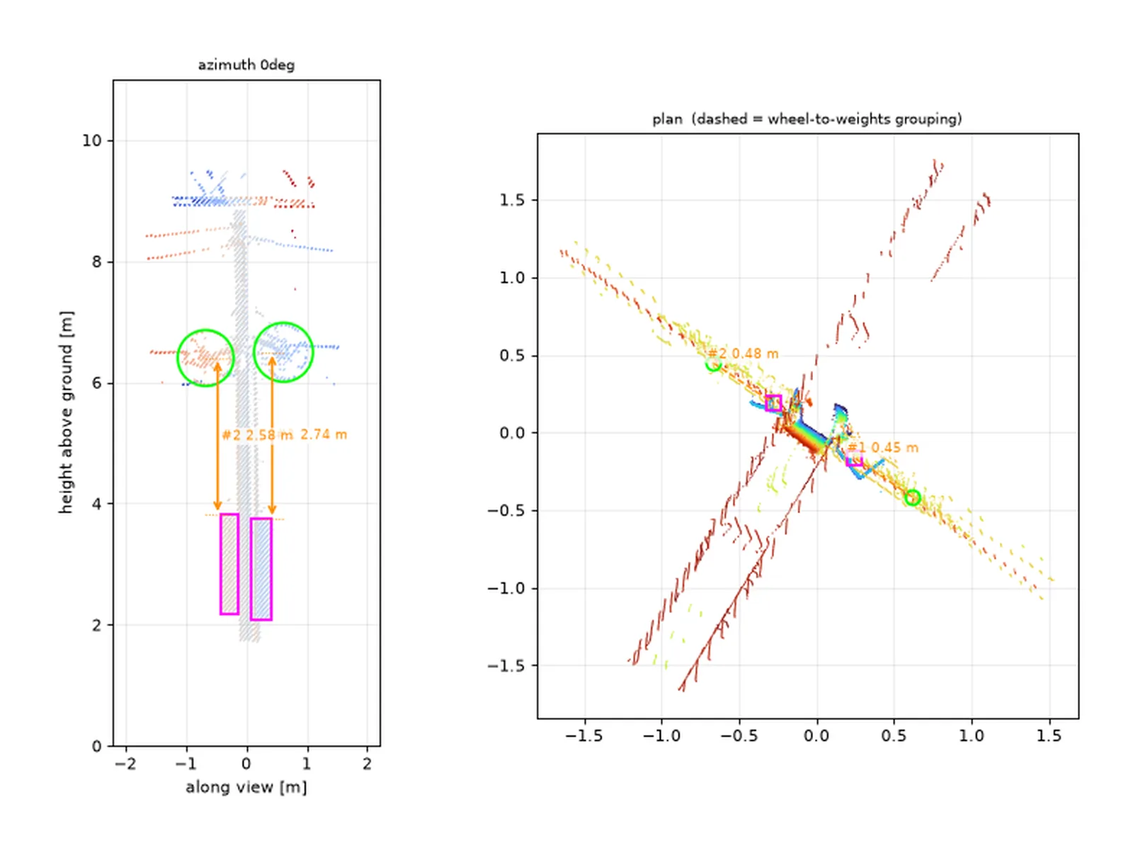
Point cloud of a catenary mast carrying two tensioners: wheels circled, weight stacks boxed and each drop measured separately
3D LiDAR · Overhead Line

Tensioners: 301 measured from one survey

A single survey job over a multi-track corridor returned 301 catenary tensioners, located and measured, without a return visit to site. Each comes with its measured drop, its position and a QA image, and every tensioner is checked from several scanners and passes.

301tensioners measured
± 49 kmmulti-track corridor
0possessions
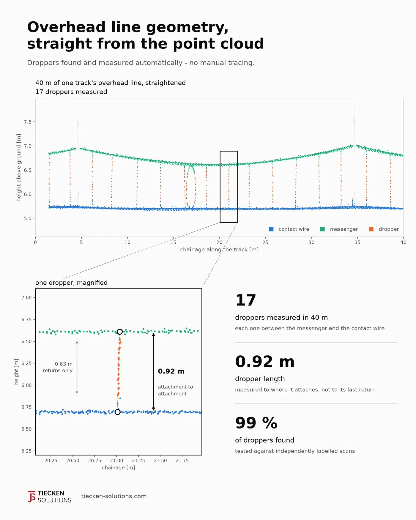
Side view of 40 m of overhead line from a laser scan with contact wire, messenger and seventeen measured droppers
3D LiDAR · Overhead Line

Droppers: found and measured

Droppers are measured from their clamp on the messenger to their clamp on the contact wire. The laser returns on a dropper stop short of both clamps, so a length read from the returns alone falls about a third short. We measure to where the dropper actually attaches. Tested against independently labelled scans the model had never seen.

99%of droppers found
96%measured between both clamps
98%of points reported as wire are wire
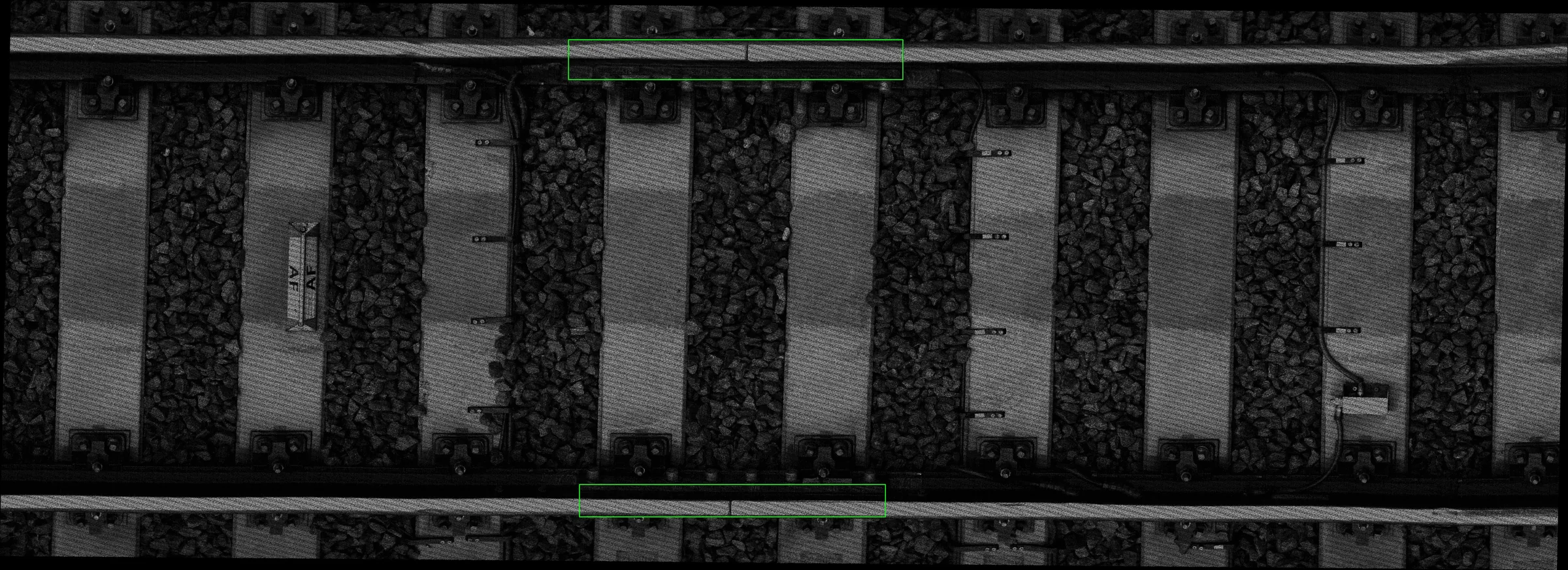
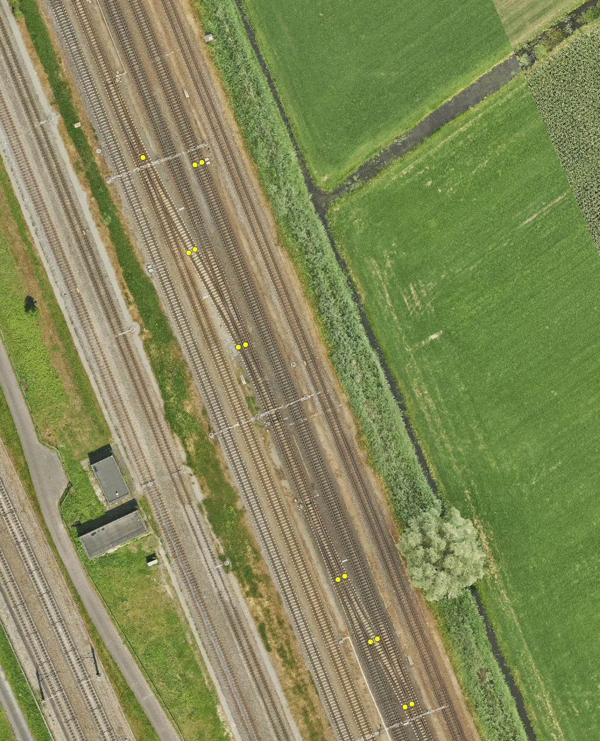
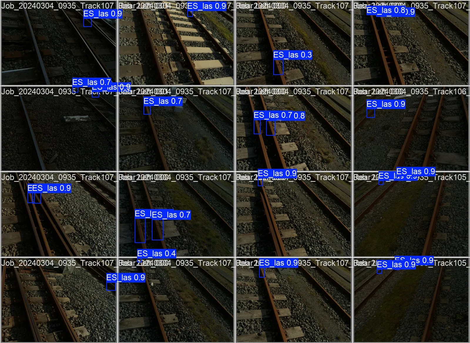
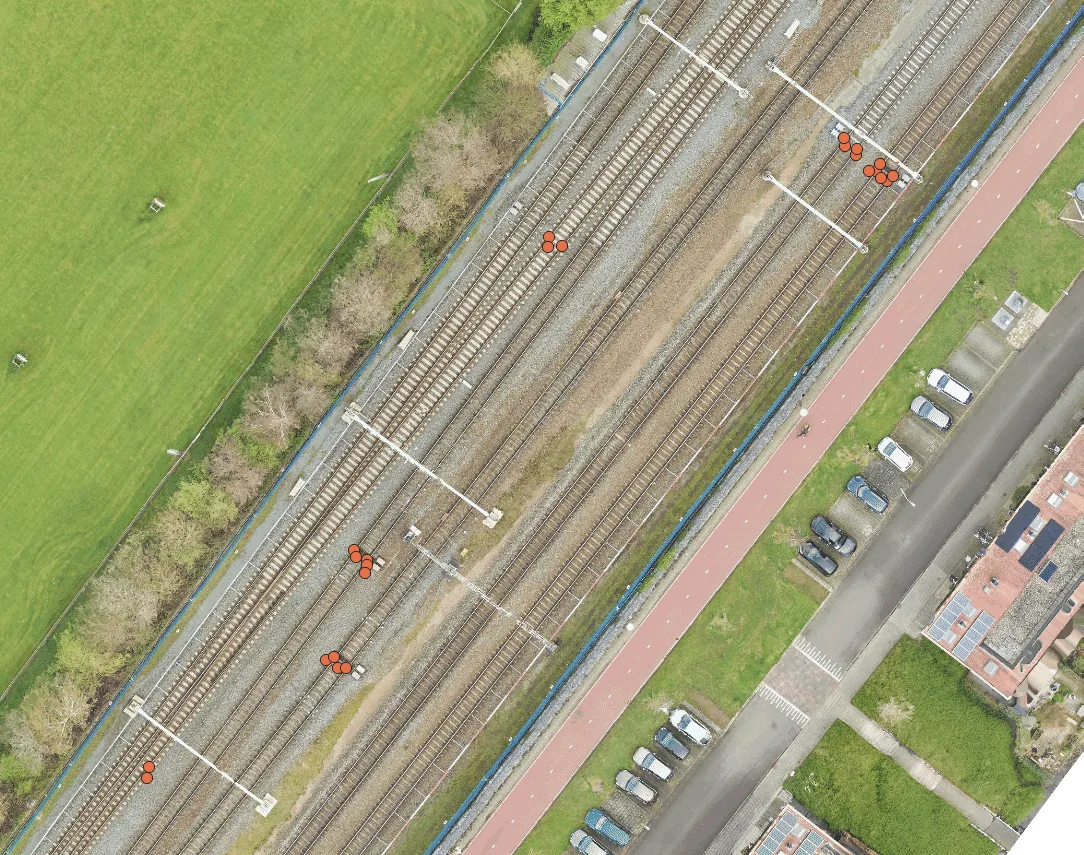
Insulated Rail Joint GeoTIFF Mapping 4 Images
Computer Vision & Geolocalization

Insulated Rail Joint Detection & Localization

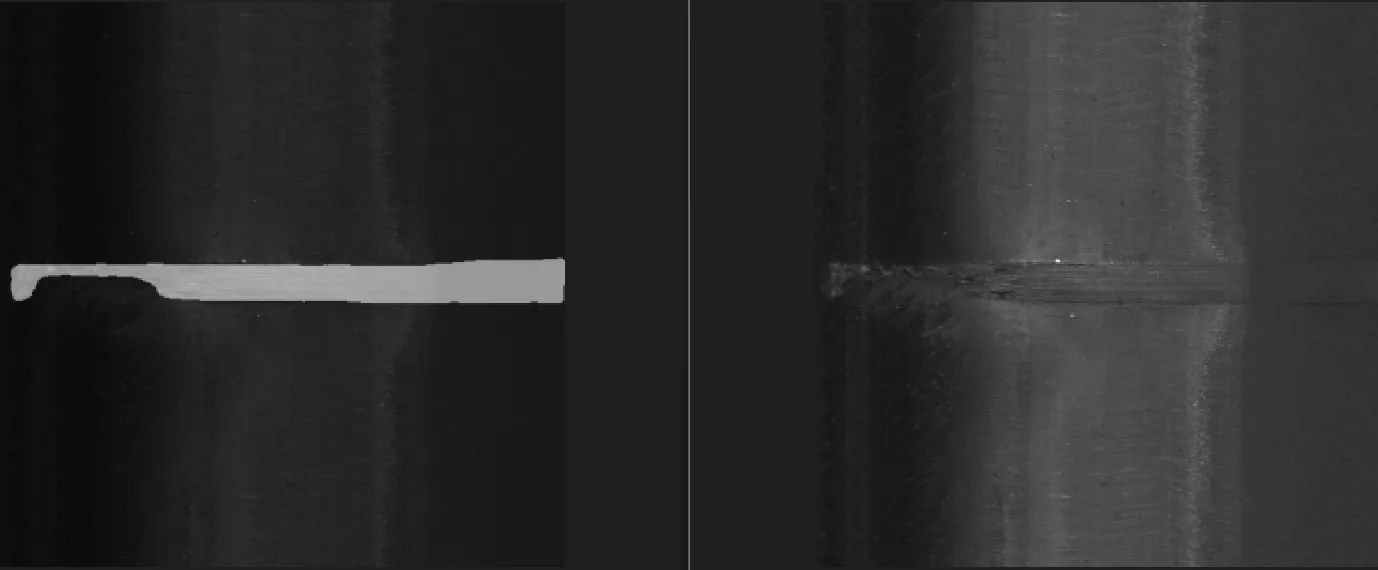
Automated detection and high-precision positioning of insulated rail joints (IRJs) using two complementary localization methods: GeoTIFF mapping with top-down linescan cameras and triangulation across forward-facing camera feeds.

GeoTIFF Linescan 1
GeoTIFF Linescan 2
Camera Triangulation 1
Camera Triangulation 2

Featured Projects & Collaborations

Computer vision, LiDAR and inspection solutions, developed for and with partners in the rail sector.

Client Quote

System Integration & Data Pipeline for Leonardo Inspection Train

"Tiecken Solutions is the partner with which Strukton Rail develops and implements groundbreaking, railway-related innovations in a pragmatic way. Innovations that are conceived and rolled out together with our operations."

Project

Detection & Localization of Insulated Rail Joints

In collaboration with IGL (Masters in Measurement), we developed advanced Computer Vision algorithms for automated detection and high-accuracy geographic positioning of insulated rail joints (IRJs) across railway networks.

Our Solutions in Practice

AI applications from our projects in image recognition, 3D point cloud analysis and GIS localisation. Click any visual to enlarge.

Catenary object detection 2 Images
Computer Vision & 2D

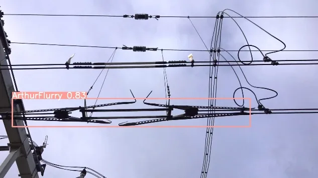
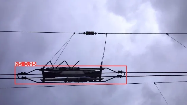
Catenary Object Detection

Development of a Computer Vision model that automatically detects overhead line (catenary) components from high-speed imagery. Significantly accelerates inspection routines and ensures consistent object classification.

Catenary detection 1
Catenary detection 2
Counterweight Measurement Point Detection 2 Images
Computer Vision & Measurements

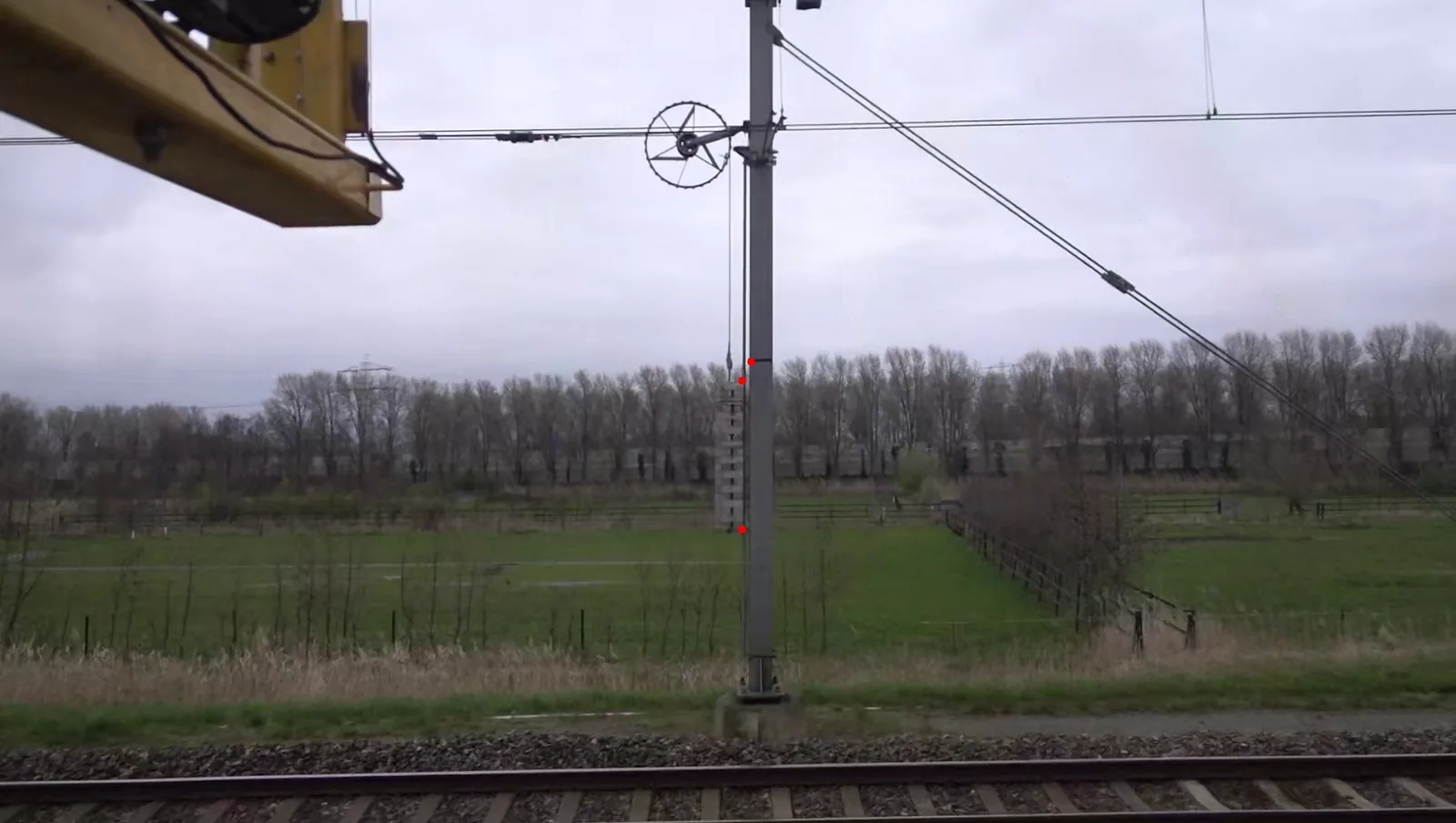
Catenary Counterweight Measurement

Automated vision-based system to verify the position of catenary tension counterweights safely from a distance, removing the need for inspectors to enter active track areas.

Measurement Point 1
Measurement Point 2
Insulation Gap Segmentation
Computer Vision & Segmentation

Rail Joint Insulation Analysis

Image segmentation application that detects insulation layers within rail joints. Using calibrated pixel scaling, the system calculates the exact minimum thickness and identifies structural wear.

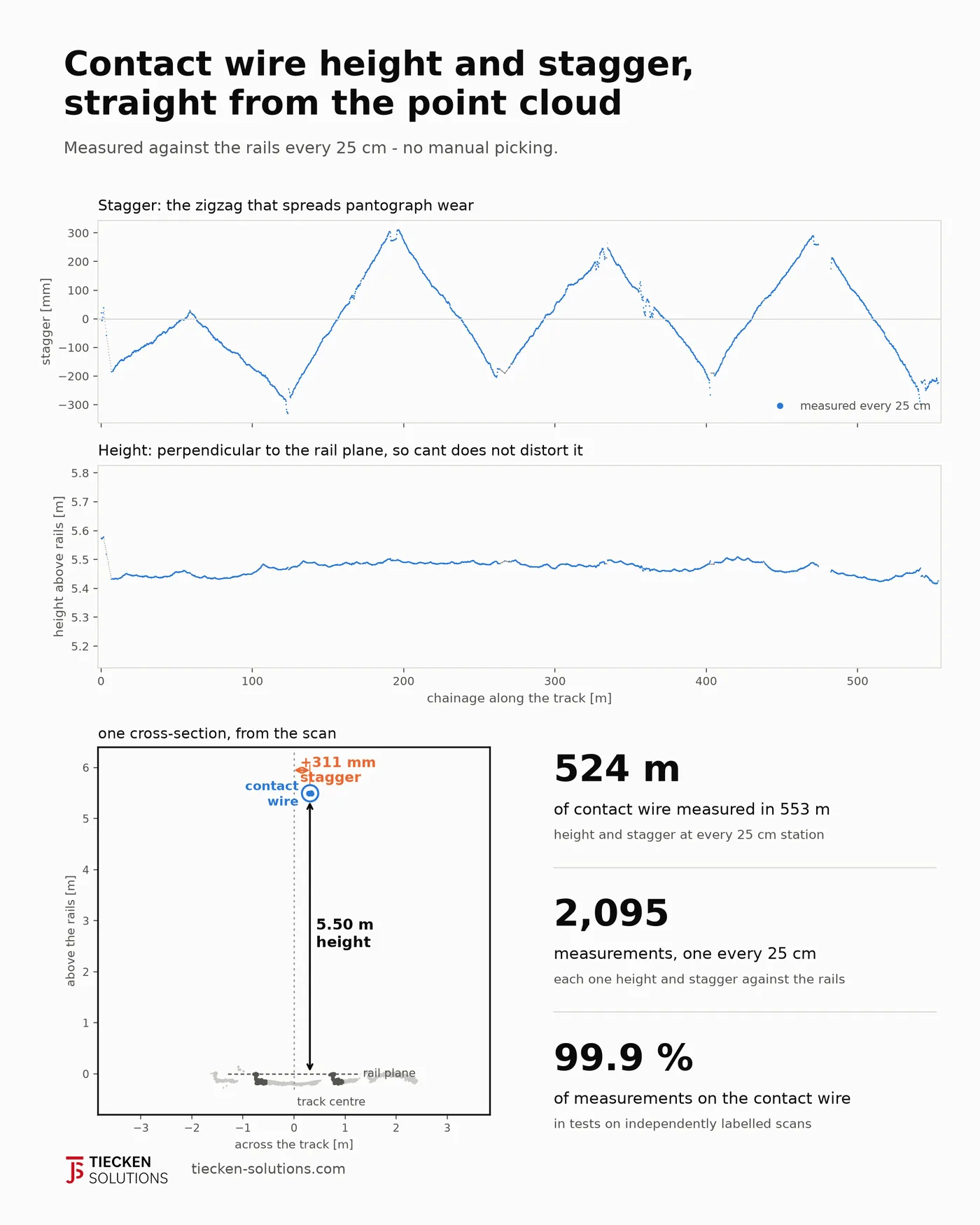
Charts of contact wire stagger and height along 550 m of track, with one cross-section from the scan
Point Clouds & LiDAR

Contact wire: height and stagger

Contact wire height and stagger measured against the rails every 25 cm, over hundreds of metres at a time, with nobody picking points by hand. Height is taken perpendicular to the rail plane, so cant does not distort it. The accuracy is that of the survey the measurement comes from.

25 cmmeasurement interval
99.9%of measurements on the contact wire itself
3D Vegetation Segmentation 2 Images
Point Clouds & LiDAR

3D Railway Vegetation Control

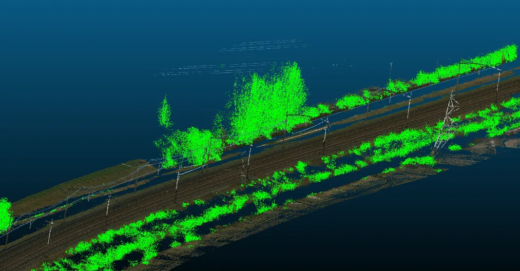
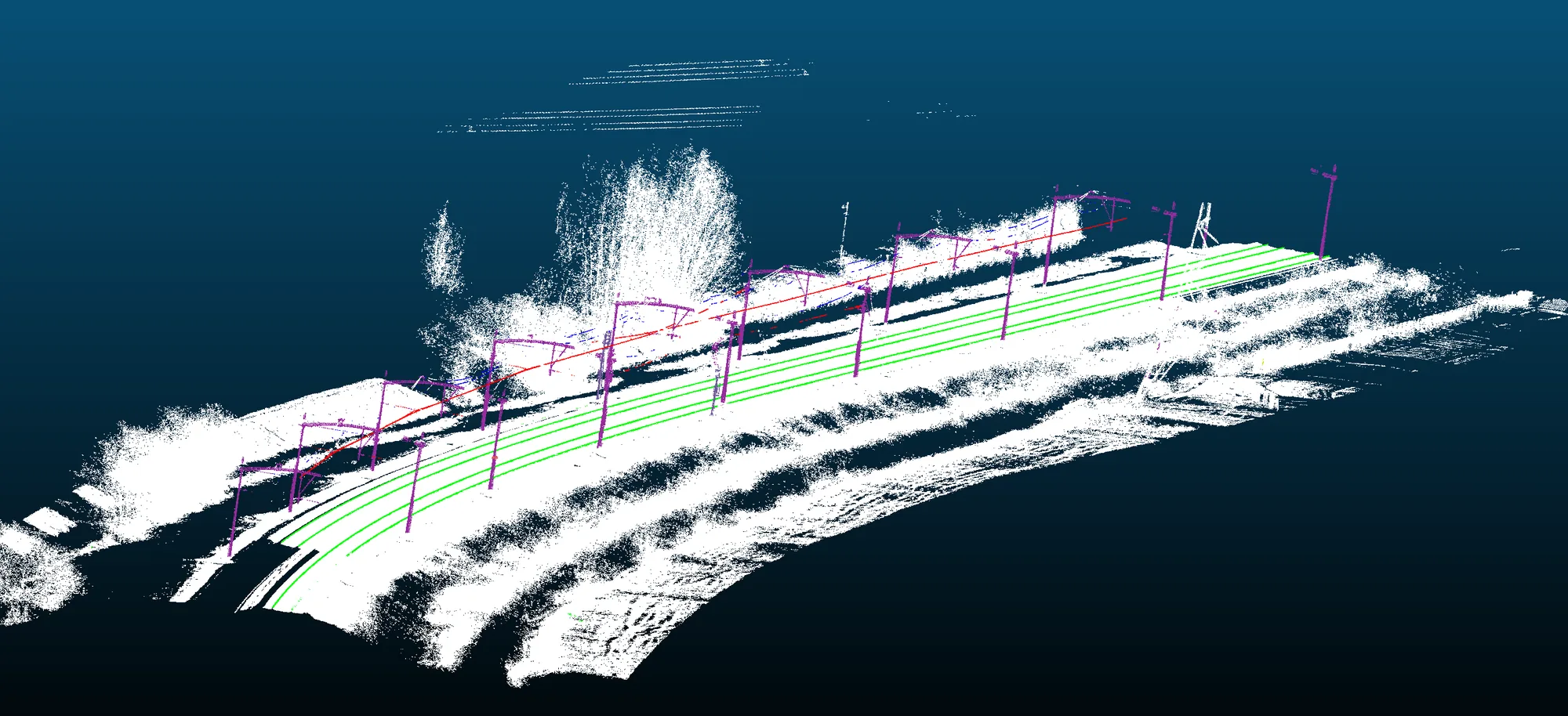
3D point cloud segmentation model that classifies rails, overhead lines, and vegetation. Calculates millimeter-precise clearances between vegetation and critical rail assets to optimize trimming schedules.

3D Vegetation 1
3D Vegetation 2
Asset Detection in BEV and 3D 2 Images
Point Clouds & LiDAR

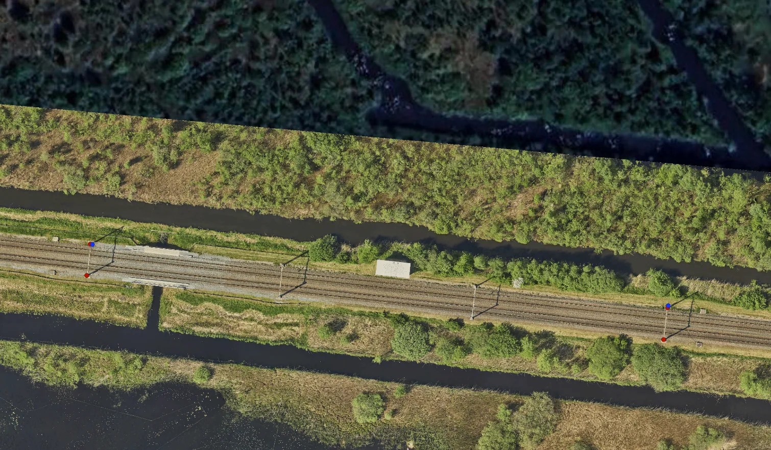
3D Point Cloud Asset Detection

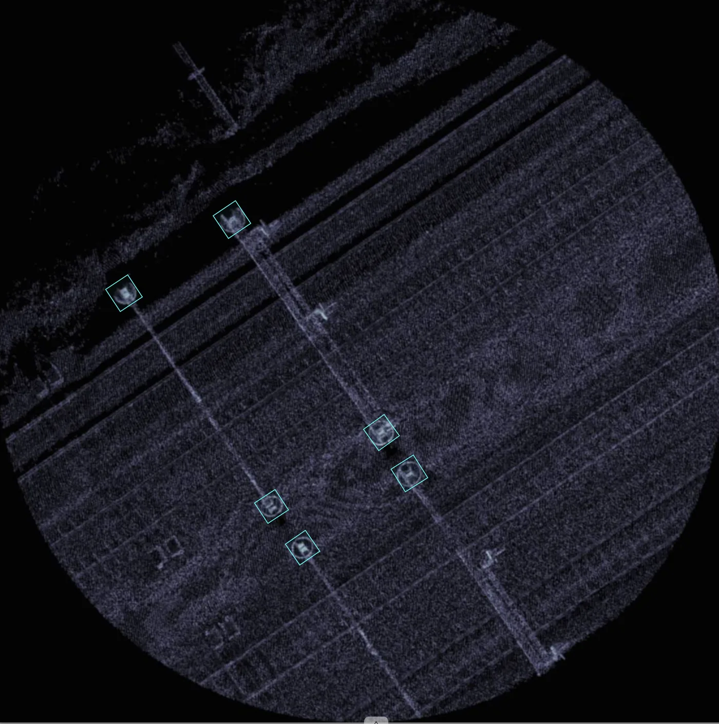
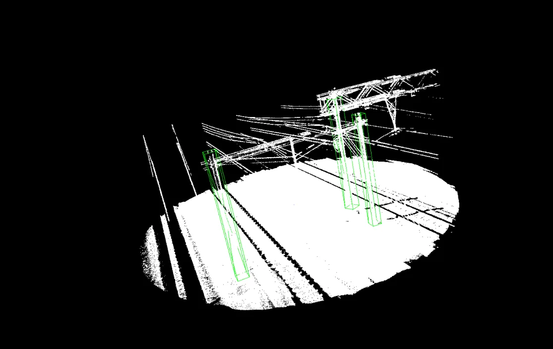
Infrastructure asset identification using both Bird's-Eye-View (BEV) projections and direct 3D spatial object recognition—ideal when 2D camera footage is occluded or height metadata is essential.

Point Cloud BEV
3D Direct Detection
Collision Detection Envelope Simulation
3D Point Clouds & Safety

3D Clearance & Collision Detection

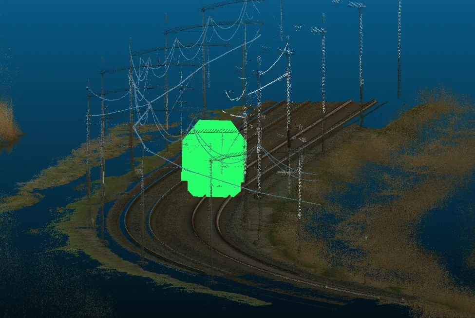
Combining 3D point clouds with high-precision GPS and IMU data (pitch, yaw, and roll). A virtual vehicle gauge clearance model traverses the point cloud to identify potential infrastructure collisions.

The same methods in other sectors

Our models were developed on rail data. A different asset or sector mainly calls for new training data; the processing chain stays the same.

Power networks

Conductors, towers and vegetation clearance from LiDAR line-inspection data. This builds directly on our wire and mast analyses for the overhead line.

Roads & structures

Road furniture, signage and clearance from mobile mapping data. GPR analysis for asphalt layers and buried objects is in development.

Industry & buildings

Scan-to-BIM: converting point clouds into IFC models (R&D). Document Intelligence: AI agents and RAG pipelines that search specifications, standards and reports, fully on-premise where required.

Survey & mobile mapping firms

Automated analysis of your point clouds and imagery as part of what you deliver to your client, as in our project with IGL.

How we start

1

Data

You supply a bounded set of inspection imagery or LiDAR data. No new capture is needed.

2

Proof of value

We show, on your own data, what is automatically detectable and measurable, confidence scores included.

3

Scale-up

Model and pipeline are fitted into your existing inspection chain and systems.

A concrete proposal

Pick one question about your assets that you suspect your existing survey data already answers. Within that scope, we will show you what can be taken out of it.

Discuss your question

The Team Behind Tiecken Solutions

Personal commitment, deep AI expertise, and extensive domain experience in rail engineering and civil infrastructure.

Sjoerd Tiecken

Sjoerd Tiecken

Co-Founder / Principal AI Engineer

Specialized in Computer Vision, Deep Learning, 3D LiDAR processing, and building custom AI software for railway inspections and smart asset management.

Connect with Sjoerd on LinkedIn
Jacques Tiecken

Jacques Tiecken

Co-Founder / Senior Advisor & Infra Specialist

Extensive experience in rail engineering, measurement technology, innovation, and process integration in complex infrastructure projects.

Connect with Jacques on LinkedIn